MTB

The Melgaço Mountain Biking Center offers five clearly marked trails with varying difficulty levels, covering a distance of 170 km. This center is part of a network of municipal facilities dedicated to preserving and promoting local identity and providing hospitality and support to visitors to Melgaço.

At Porta de Lamas de Mouro, in a large leisure area, set in a paradisiacal natural environment, there is a support facility for practitioners of the sport who can enjoy some equipment, such as changing rooms and a specific parking area.

blank

A circular route accessible to all mountain bikers or those looking to get started. It runs through the leisure area surrounding the mountain bike center in a paradisiacal rural setting integrated into the Peneda Gerês National Park.

blank

Starting Point andArrival:Lamas de Mouro (Porta PNPG) 42°02’20.7″N 8°11’45.0″W
Distance: 4.25 Km – Circular
Duration on Bike: 00h30 – 01h00
Difficulty: Easy
Max Height : 883m
Min Height: 863m
Accumulated positive unevenness: 57m

blank

This easy-to-follow mountain bike trail is ideal for beginners or those seeking a leisurely ride surrounded by nature. 11 km long and with a positive elevation gain of 428 meters, the route begins with a brief technical section in the first 2 km, then follows accessible and fluid trails. The route follows the banks of the Minho River, continues towards the Melgaço Thermal Baths, and ends at the Training Center. It’s a pleasant route, with natural landscapes and passes by local points of interest.

blank

Starting Point andArrival:Melgaço Training Center 42.118572, -8.271128
Distance: 11 Km – Circular
Difficulty: Easy
Max Height : 128m
Min Height: 32m
Accumulated positive unevenness: 428m

blank

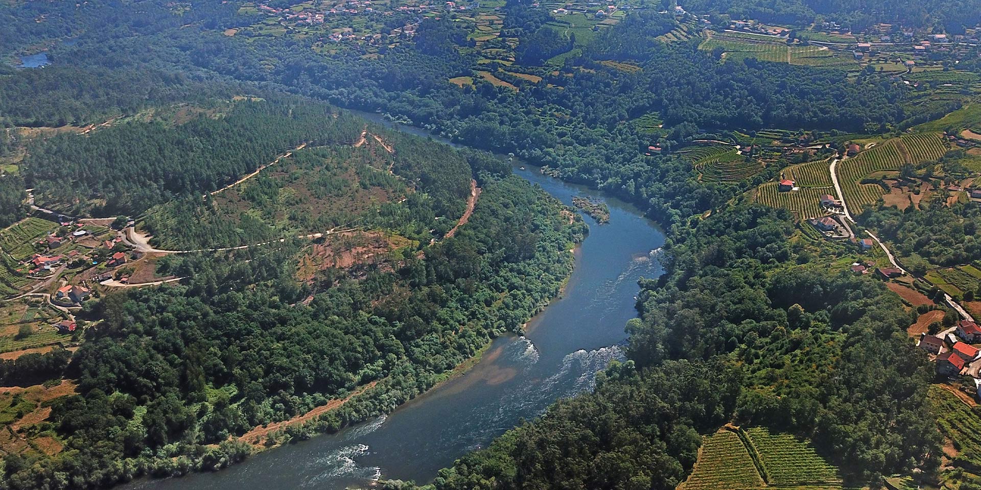
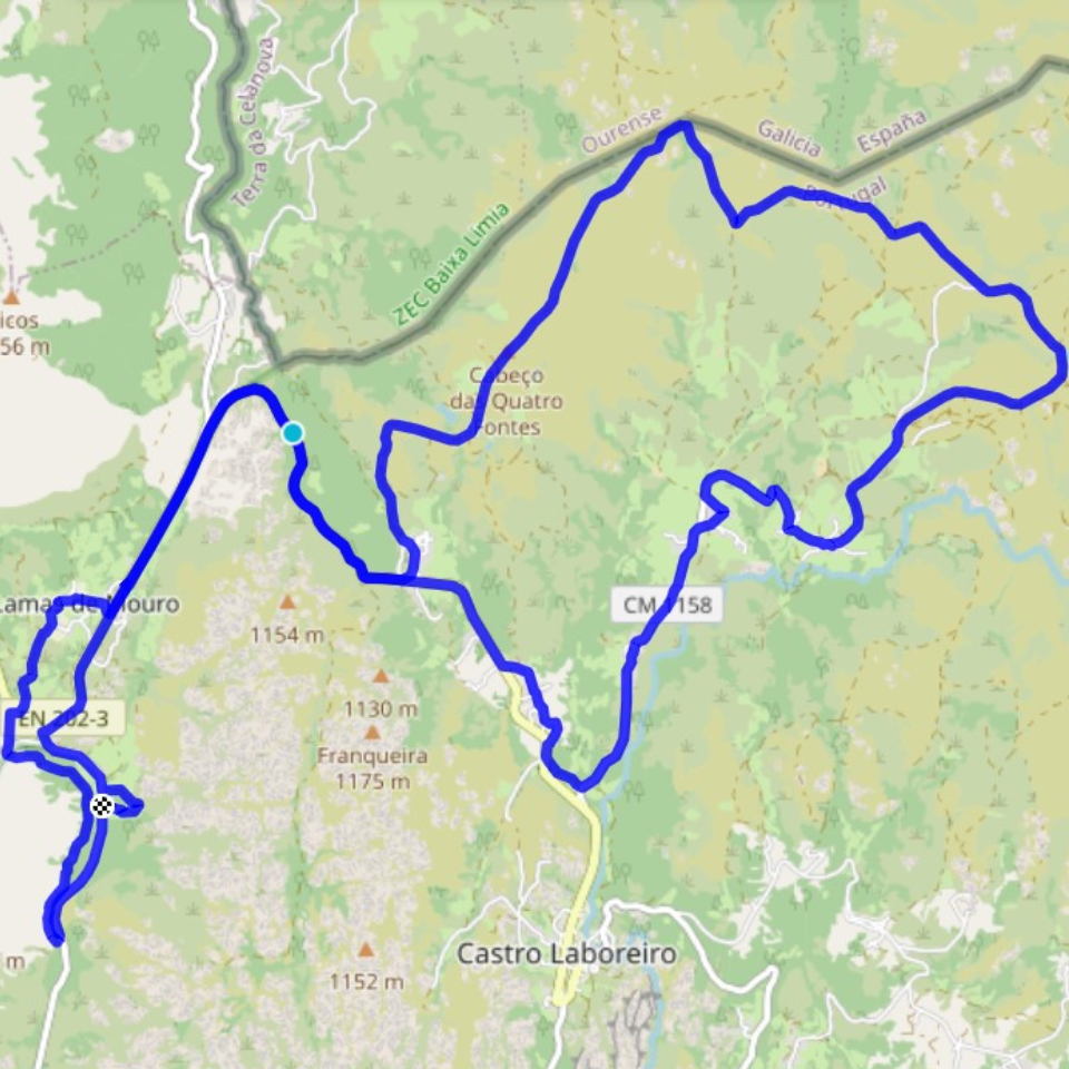
This moderately difficult route (blue rating) departs from the Melgaço Training Center towards Cevide, the northernmost point of Portugal. Throughout its 23.1 km and 996 meters of elevation gain, the route runs primarily parallel to the Minho River, offering unique natural landscapes and varied trails, ideal for those with some mountain biking experience. One of the route’s highlights is the passage of Portugal’s Milestone No. 1, near the border with Galicia—a symbolic site steeped in historical significance. The return journey follows the same route, allowing you to relive the route from a new perspective. An accessible and memorable challenge for nature and cycling lovers.

blank

Starting Point andArrival:Melgaço Training Center 42.118572, -8.271128
Distance: 23.1 Km Back and Forth
Difficulty: Medium
Max Height : 165m
Min Height: 37m
Accumulated positive unevenness: 996m

blank

A trail with a short common initial and final section and a circular central section.

A moderate trail through the Castro Laboreiro plateau, entering at Portelinha, exiting at Rodeiro, and passing through several Castro Laboreiro “brandas.” This trail is integrated into the Peneda Gerês National Park area.

blank

Starting Point andArrival:Lamas de Mouro (Porta PNPG) 42°02’20.7″N 8°11’45.0″W
Distance: 29.8 Km – Circular
Duration on Bike:
Difficulty: Medium
Max Height : 1194m
Min Height: 867m
Accumulated positive unevenness: 647m

blank

A circular route, starting at P2, through the Castro Laboreiro plateau, exiting at Rodeiro and passing through the Alto da Fecha single track, heading towards the village of Castro Laboreiro, increasing in difficulty due to several short technical sections. This route is integrated into the Peneda Gerês National Park.

blank

Starting Point andArrival:Lamas de Mouro (Porta PNPG) 42°02’20.7″N 8°11’45.0″W
Distance: 34.20 Km – Circular
Duration on Bike:01h00 – 02h30
Difficulty: Red
Max Height : 1194m
Min Height: 864m
Accumulated positive unevenness: 790m

blank

This trail provides a pleasant walk along the Laboreiro River, which rises on the Castro plateau, on the western slope of the Serra do Laboreiro, close to the Galician border, and crosses the entire territory. As it turns south, the river marks the border between the Peneda and Laboreiro mountain ranges.

In its final stretch, of around 14 km, it marks the border between Portugal and Spain and flows into the Lima River. The trail begins in the town of Castro Laboreiro, shortly after which it reaches the Museum Centre and, shortly after, a natural viewpoint (A) that provides a panoramic view of the Laboreiro waterfalls and the town’s old bridge. In this mountainous location, this waterfall crosses a steep drop and falls from the top of high rocky cliffs.

Within this panoramic view, you can also admire the ancient watermills once used to grind rye, an essential raw material for making Rye Bread, the famous Castrejo Bread. Winding down the mountain, its banks are connected by bridges built by various civilizations over time, which remain here. In the final stretch of the route, you’ll have the opportunity to cross the Varziela Bridge (C). Of the numerous historic bridges that remain, the Varziela Bridge bears the greatest traces of having been built in the medieval period. However, some authors point to the medieval redesign of ancient Roman bridges, which is also what happened with this bridge.

These are just a few examples of the endless opportunities Rio de Janeiro offers. Throughout its length, it boasts clear natural pools surrounded by giant cliffs and breathtaking waterfalls—perfect ingredients for canyoning (D), a recreational exploration activity that allows us to visit and explore the most beautiful and hidden corners of this mountain river.

Fauna: Otter (lutra lutra), Water mole (Galemys pyrenaicus), River trout (salmo trouta fario)

Flora: Alder (Alnus glutinosa), Woodland heather (Senecio nemorensis), White heather (Erica arborea)

blank

Starting Point andArrival: Melgaço Training Center – 42.118572, -8.271128
Distance: 37.6 Km – Circular
Difficulty: Hard
Max Height : 750m
Min Height: 45m
Accumulated positive unevenness: 1532m

blank

A technically demanding figure-of-eight route that begins at the same time as P2 and P3. It runs along the entire Castro Laboreiro plateau, entering at Portelinha and exiting via the Portos “branda” (road sign). It also passes through the Padrosouro “branda” (road sign), Cainheiras “Inverneiras” (road sign) and Varziela, heading towards the town of Castro Laboreiro. This route offers significant scenic and heritage interest within the Peneda Gerês National Park.

blank
Starting Point andArrival: Lamas de Mouro (Porta PNPG) 42°02’20.7″N 8°11’45.0″W
Distance: 47,70 Km – Circular
Duration on Bike:03h00 – 05h00
Difficulty: Very Hard
Max Height : 1272m
Min Height: 864m
Accumulated positive unevenness: 1181m
blank

A circular route through various types of trails, including technical sections and steep inclines.
It runs through an area of the municipality with diverse heritage (Mamoa do Batateiro, Branda da Aveleira, Covelo, Mourim, and Mosteiro de Fiães). This route is very demanding both physically and technically.

blank
Starting Point andArrival: Lamas de Mouro (Porta PNPG) 42°02’20.7″N 8°11’45.0″W
Distance: 61,50 Km – Circular
Duration on Bike:03h00 – 04h45
Difficulty: Very Hard
Max Height : 1164m
Min Height: 606m
Accumulated positive unevenness: 2307m
blank

A challenging and technical route, recommended for experienced cyclists seeking varied terrain and mountain scenery.

With 66.5 km long and with a positive elevation gain of 2,183 meters, this route requires both physical and technical fitness, beginning with a long and demanding climb just outside the Melgaço Training Center, heading towards Fiães.

From there, the route follows more technical trails to the Orjás region, before reaching the Picos Wind Farm. This high-altitude section offers stunning panoramic views, with open horizons over the mountains, the Minho Valley, and, on clear days, even the mountains of Galicia.

This is followed by a long and fluid descent through Lamas de Mouro, gradually delving into the Alvarinho Valley, where the landscape transitions to wine-growing areas and denser forests, typical of the terroir of the region’s premier grape variety.

The route ends with the return to the Training Center, concluding an intense challenge that combines technical trails, natural beauty, and a variety of environments—from the mountains to the heart of the Alvarinho region.

blank
Starting Point andArrival: Lamas de Mouro (Porta PNPG) 42°02’20.7″N 8°11’45.0″W Distance: 66.50 Km – Circular Difficulty: Very Hard Max Height : 1176m Min Height: 87m Accumulated positive unevenness: 2183m
blank

A mountain bike trail with extremely high physical and technical demands, reserved for experienced and well-prepared cyclists. With 99.4 km and 3,371 meters of elevation gain, this epic route traverses some of the most remote and impressive landscapes in the municipality of Melgaço and the Peneda-Gerês National Park.

The start is at the Melgaço Training Center, and the climb begins through Fiães and Alcobaça, heading towards the imposing Castro Laboreiro plateau—one of the highest and most emblematic points in the region, with vast, open landscapes and a unique natural environment. After crossing these mountainous areas, the route continues to the picturesque Branda da Aveleira, where the altitude and isolation are felt, reflecting the ruggedness and beauty of the mountains.

This is followed by a long, technical descent to the Chapel of São Tomé, a transition point between the mountainous environment and the Minho Valley. The route then continues toward Melgaço Hot Springs, crossing gentler forest trails, before returning to the starting point at the Training Center.

This is a comprehensive and memorable challenge, combining extreme effort, varied terrain, and breathtaking scenery.

blank
Starting Point andArrival: Melgaço Internship Center 42.118572, -8.271128 Distance: 99.4 Km – Circular Difficulty: Very Hard Max Height : 1270m Min Height: 45m Accumulated positive unevenness: 3371m

From our gallery